

(This article is written from the owner’s 1st person perspective with additional Death Valley National Park resources on additional camping locations and all the hiking options at the bottom)
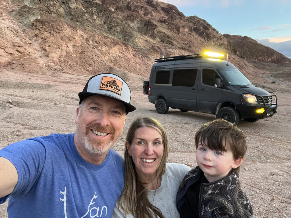
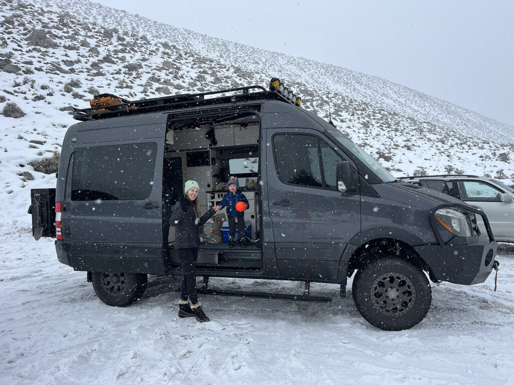
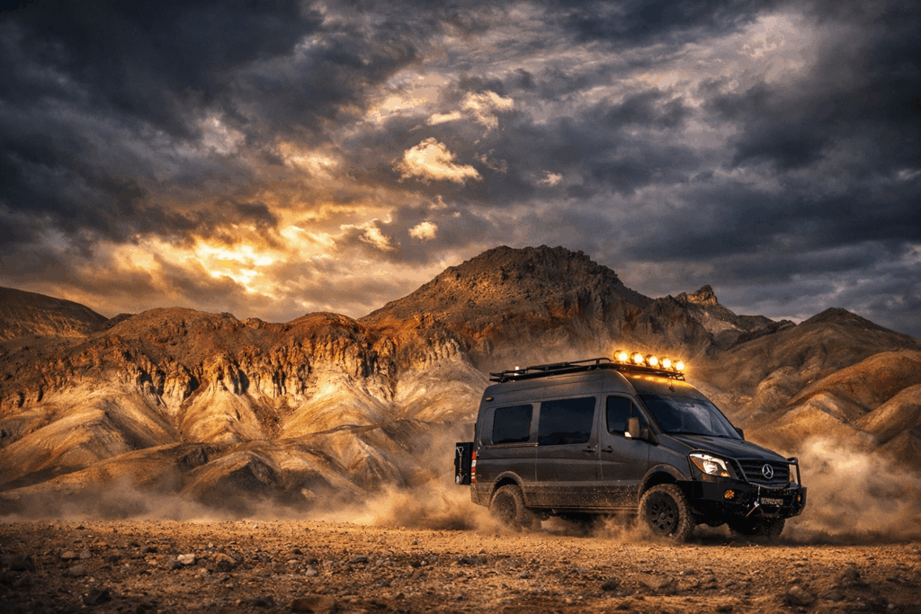
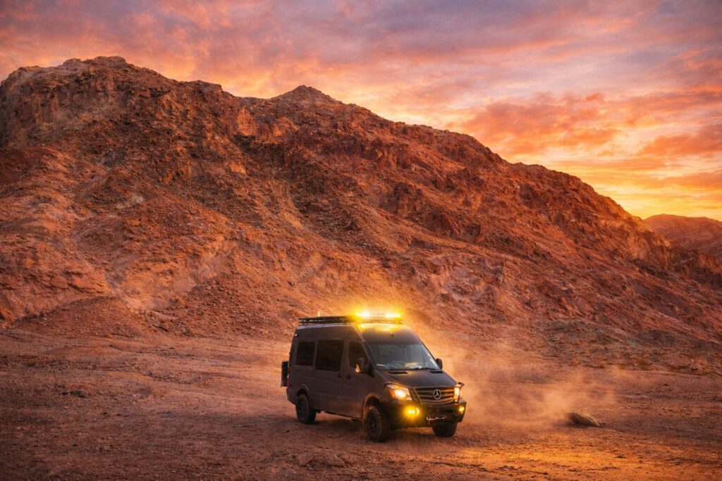
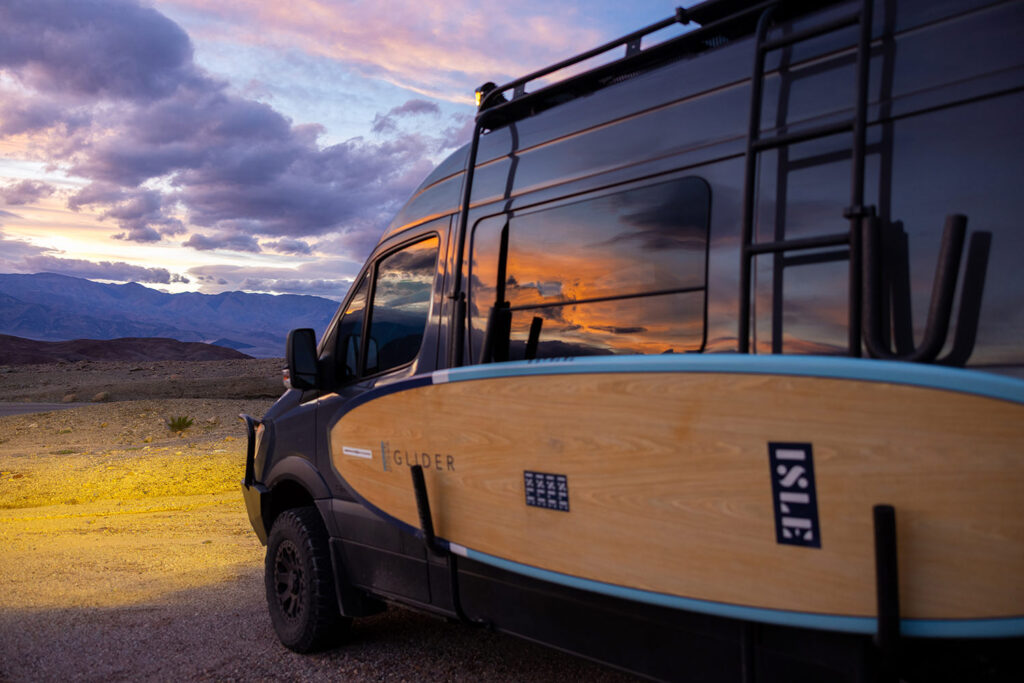
We wanted to kick off the new year with an epic van trip in the new Van Voyage Adventure Camper Van—a 2017 Sprinter 2500 Sportsmobile build now operating under the name Field Vans out of Fresno. This van is extremely off-road capable, equipped with two full-size spare tires, an extended 45-gallon fuel tank, and a winch. The goal of this trip was to truly put the van to the test in real off-road conditions. And of course, it was also about enjoying a classic New Year’s van trip up Highway 395.
The plan was ambitious from the start. Our route would take us to Trona Pinnacles, Alabama Hills, a hike at Big Pine Lakes, through Owens River Valley, and finish with some paddleboarding at Mono Lake. I know what you’re thinking—that’s a lot. And you’re not wrong. But the entire idea was to push the limits of this van and jam-pack as much adventure as possible into a four-night, five-day Eastern Sierra exploration along Highway 395.
Everything was shaping up perfectly—except for one major variable: the weather. Right before our trip, a massive storm slammed the Sierra Nevadas. At first, I wasn’t too concerned. Typically, a big storm doesn’t immediately follow another big storm. Unfortunately, I was wrong. A second solid storm was forecasted to hit the Sierras right in the middle of our trip. Still, we decided not to let that deter us and continued forward with our plans.
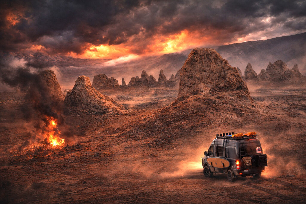
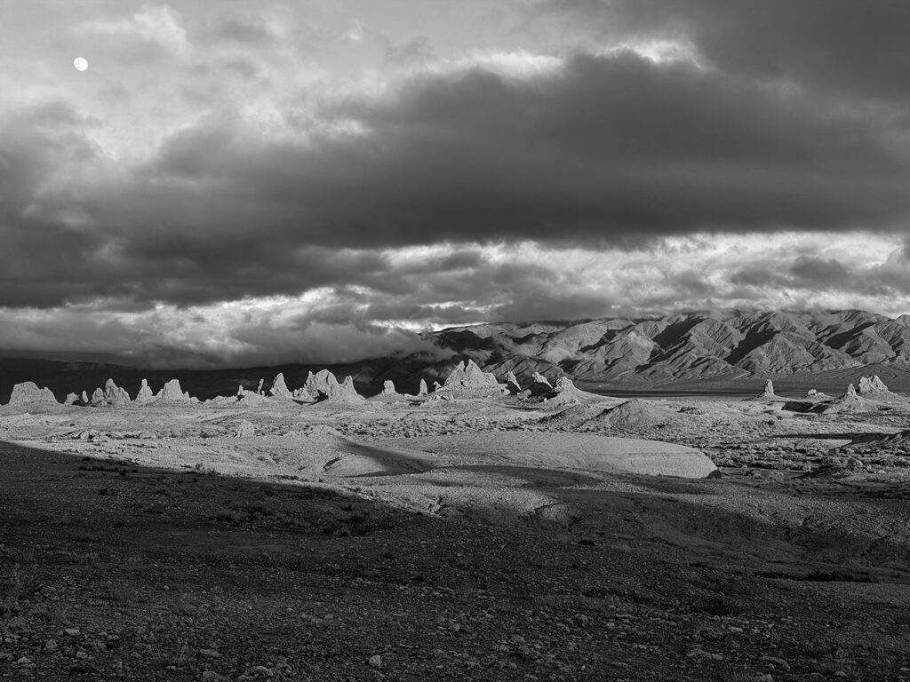
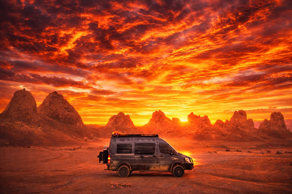
Early on New Year’s Day, we hit the road, with our first destination set as Trona Pinnacles. Located near the town of Ridgecrest, not far from San Bernardino, Trona Pinnacles feels like a completely different planet once you arrive. What was once an ancient seabed is now a vast, flat valley punctuated by dramatic limestone pinnacles rising from the ground—almost Martian in appearance.
To assess dirt road conditions, we use an app called OnX, which has proven to be incredibly helpful. Normally, the dirt road into Trona Pinnacles is rated a 1 out of 10. However, after the recent storm, conditions were anything but normal. The road had turned into a muddy, soupy mess. When we arrived, we spoke with a ranger who had been pulling vehicles out of the mud all day and strongly advised against continuing.
But if we were truly going to test the capability of this van, this was the moment. So we went for it. The drive in was bumpy and extremely muddy, but the van handled it without issue. Once through, we began searching for a dispersed campsite.
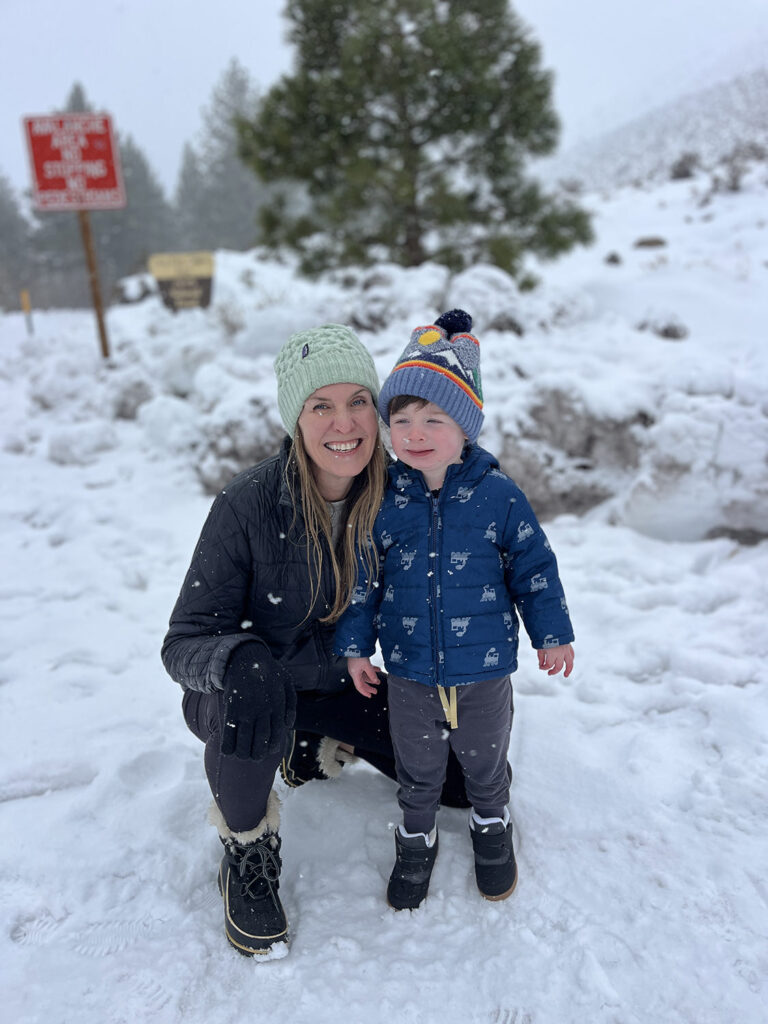
Dispersed camping is essentially unofficial camping—no running water, no bathrooms, and no built structures. Often, the only indication of a campsite is a simple fire ring. Trona Pinnacles has quite a few dispersed sites, and we found one that was perfect. We settled in for the night, enjoying a campfire beneath a sky full of stars.
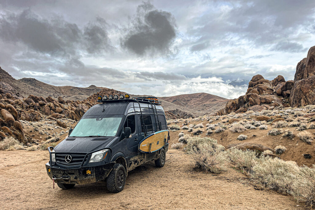
The following day, after exploring the pinnacles, we headed north to what I had been most excited about: Alabama Hills. Located near the town of Lone Pine—about two hours north on Highway 395 from Trona Pinnacles—Alabama Hills is a well-known dispersed camping destination within the van-life community. It sits directly beneath Mount Whitney, the tallest mountain in the contiguous 48 states. Access to the area is via Movie Road, aptly named due to the countless westerns and modern films shot there over the years (Ironman, Tremors, Django Unchained, Gladiator and about 200 more have used this area).
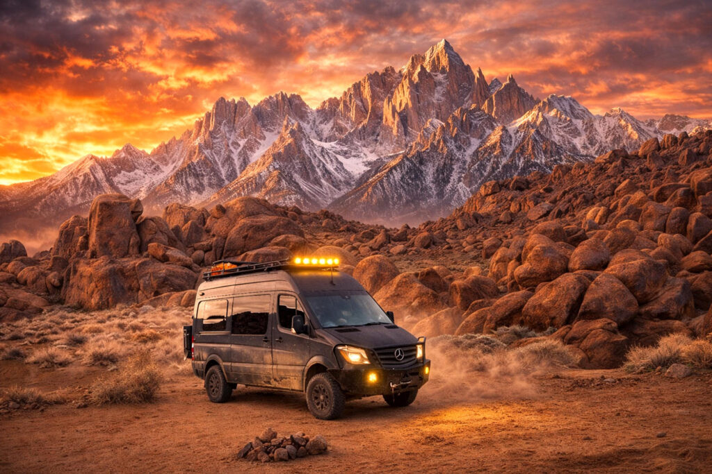
Alabama Hills can best be described as a high-desert version of Joshua Tree, with massive clusters of boulders scattered across rolling hills and valleys. One of the unique aspects of this area is its proximity to Lone Pine; despite being so close to town, it feels incredibly remote. And it absolutely delivered. What truly sets Alabama Hills apart is the jaw-dropping view of Mount Whitney and the Eastern Sierra mountain range—it’s nothing short of spectacular.
We ultimately chose one of the most secluded sites, far down the dirt road. While we passed several incredible spots along the way, this one stood out. Since the drive from Trona Pinnacles had been relatively short, we had plenty of time to explore the surrounding rock formations before settling in. That evening, we enjoyed a simple but satisfying ramen dinner, followed by yet another campfire under a clear, star-filled sky.
The next storm was approaching quickly, so the following morning we cooked breakfast fast, packed up, and continued north on Highway 395. Our next intended destination was Owens River Road Dispersed Camping, located directly along the Owens River about seven miles north of the Mammoth Lakes turnoff. As we drove north, the storm hit hard. By the time we reached Bishop, every vehicle coming from the north was carrying at least a foot of snow on their roof racks, and multiple road signs warned of blizzard conditions ahead.
At that point, it made sense to pivot again and grab a hotel for the night. We found availability at the Wayfinder Hotel in Bishop. The lobby already had a fire going, with families enjoying the den area, and it immediately felt like the right call.
Bishop is often thought of as just a stop on the way to Mammoth Mountain, but the town itself has plenty to offer. One standout is Mahogany Smoked Meats, an incredible jerky shop located on the north end of town. Another local institution is Erick Schat’s Bakkerÿ, world-famous for Sheepherder Bread.
After hot showers, a soak in the hot tub, cleaning out the van, and rinsing off all the accumulated dirt, we headed out for a relaxing dinner. Weather conditions continued to change every fifteen minutes, as they so often do in the Eastern Sierras. With uncertainty around whether Owens River Road would be accessible the next day, we made the call to head south and escape the storm system by pivoting toward Death Valley National Park.
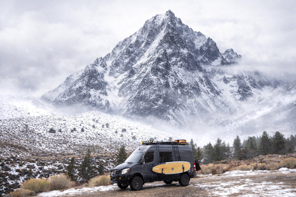
On the way south, we attempted to stop at the Big Pine Lakes trailhead, but as we climbed higher into the Eastern Sierras, snow began dumping heavily and the road was ultimately closed. Fortunately, we ran into a local who suggested a local secret spot in the Summer months: Lake Sabrina.
Lake Sabrina is created by damming the Middle Fork of Bishop Creek and sits at approximately 9,000 feet in elevation. It features a café, a dock, and is the largest and most well-known lake in Bishop Creek Canyon. The surrounding Sierra Nevada views are stunning, making it an excellent spot for fishing and paddling. Sabrina Campground is located nearby, and according to the local, there is plenty of dispersed camping along the road leading up to the lake. The campground itself has 18 self-register sites, most of which are situated close to Bishop Creek. From Bishop, you take State Route 168 (Line Street) west for approximately 18 miles. Sabrina Campground will be on the right, about half a mile past the North Lake turnoff. The planned operating season for 2026 runs from May 15 through September 7.
Initially, Death Valley National Park was not a destination I was overly excited about. While I do enjoy desert landscapes and had heard great things about the park, I was hoping for more forested environments. However, the weather had other plans, so Death Valley it was. We stopped at Panamint Springs to top off on diesel fuel. There is a campground across the street, though it’s best used as a backup option since it operates more like an RV park. FYI, Stovepipe Wells Gas Station does NOT have Diesel at the time of writing of this article. It takes about 30 minutes driving South / Southwest to Panamint Springs for a Diesel fillup.
As we entered Death Valley National Park, the sheer scale of the landscape was immediately apparent. Coming from this direction, the first major feature you encounter is the Mesquite Flat Sand Dunes, just past Stovepipe Wells Village.
Death Valley holds several extreme records: it is the hottest place on Earth, with a recorded high of 134 degrees Fahrenheit, and Badwater Basin marks the lowest elevation in North America at 282 feet below sea level. In 2024, the park experienced its hottest meteorological summer on record, with an average 24-hour temperature of 104.5 degrees Fahrenheit from June through August. It is not only hot but also extremely dry, receiving an average of just 2.2 inches of rain per year. Despite this, destructive storms have become increasingly common. During good weather, the park offers endless opportunities for exploration, including hiking, historic sites, backcountry travel, and incredible night skies.
The only reservable campground within Death Valley National Park is Furnace Creek Campground. Two additional campgrounds—Sunset Campground and Texas Springs Campground—are typically seasonal and were closed at the time, with plans to reopen in late January or early February 2026. Sunset Campground is essentially a large dirt parking lot, better suited for RVs, while Texas Springs Campground is a much better option, offering first-come, first-served sites with potable water and flush toilets. We were fortunate enough to secure a site at Furnace Creek and enjoyed yet another evening of campfire relaxation and stargazing.
One of the unique aspects of Death Valley National Park is that dispersed camping is allowed on select unpaved roads with permits. These include Echo Canyon, Hole in the Wall Road, and Greenwater Valley Road, also known as Furnace Creek Wash Road. Echo Canyon and Hole in the Wall require high-clearance four-wheel-drive vehicles and have designated dispersed campsites. Greenwater Valley Road is county-maintained and, while still considered high-clearance due to washboard conditions, is generally more manageable. Some side roads off Greenwater Valley do require four-wheel drive, and the road itself stretches all the way to Highway 178. In this area, there are no designated campsites, allowing campers to choose their own locations.
According to Death Valley National Park materials, must-see locations include Badwater Basin, Artist Drive, Zabriskie Point, Mesquite Flat Sand Dunes, Dante’s View, Harmony Borax Works, Ubehebe Crater, Charcoal Kilns, and Father Crowley Vista Point. Due to the park’s massive size and the distance between these sites, properly exploring Death Valley really requires at least two nights and three full days.
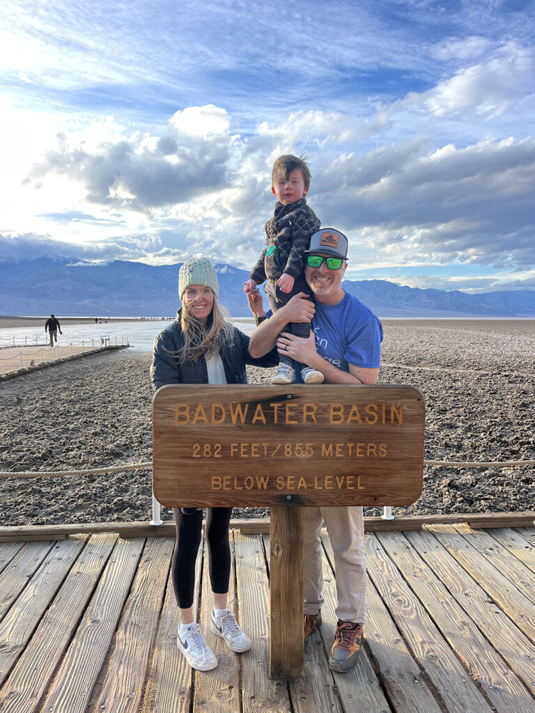
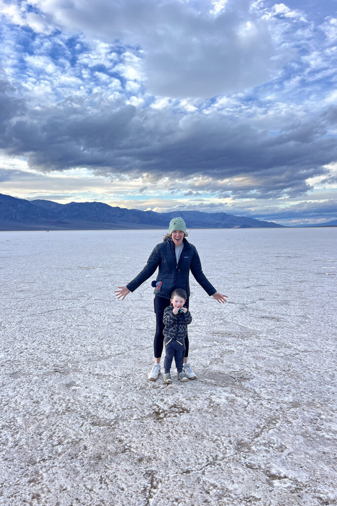
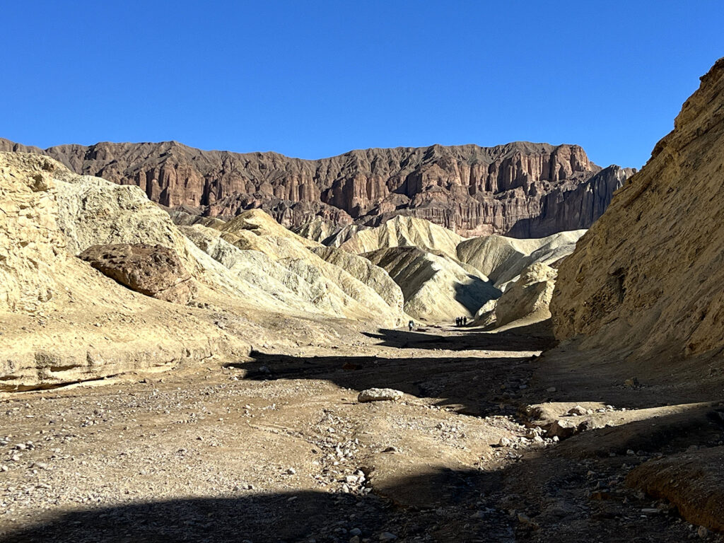
With limited time, we focused on Badwater Basin, Artist Drive, and an incredible hike through Golden Canyon to Red Cathedral. Badwater Basin was easily the highlight—standing on the expansive salt flats at the lowest point in North America is a surreal experience. Artist Drive is a scenic loop through vividly colored canyons with several viewpoints along the way. The Golden Canyon hike is approximately three miles out and back, takes about 90 minutes to two hours, and is rated moderate. The trailhead is located two miles south of Highway 190 on Badwater Road and includes a parking lot large enough for vans and RVs, along with a vaulted toilet. Another noteworthy hike we didn’t have time for was Mosaic Canyon.
Another notable stop is the Inn at Death Valley, an elegant historic hotel dating back to 1927. It has maintained a AAA four-diamond rating for more than 37 years and offers a welcome escape from the heat or wind, whether for sunset drinks overlooking the valley or a hearty breakfast.
Eventually, it was time to head home. The trip delivered incredible scenery and thoroughly tested our new adventure camper van, which passed every challenge with flying colors. On the drive back, we stopped in Baker to see the world’s largest thermometer and grabbed a hearty meal at the Mad Greek Café.
Just outside the park near Death Valley Junction, we discovered a dispersed camping area known as The Pads. With no amenities other than perfectly level concrete pads—about 120 of them—it’s an excellent backup option if park campgrounds are full or if you’re unable to secure dispersed camping permits.
Contact info for Death Valley National Park: deva_information@nps.gov (760)786-3200
Other Developed Campgrounds within Death Valley National Park Not Mentioned Above
Emigrant Campground: Temporarily Closed of January 2026 ( 36.496627547619674, -117.22754036682508 ) 10 sites but no fire pits, with tables and flush toilets. Located directly next to Highway 190 about 9 miles Southwest of Stovepipe Wells Campground.
Wildrose Campground: ( 36.26567225254337, -117.18779599950346 ) Located east of Emigrant Campground and off of Emigrant Canyon Rd down about 21.4 Miles (past Journigan’s Mill) and the drive from the highway takes about 40 minutes. This turnoff for Emigrant Canyon Rd is past Panamint Springs but before Stovepipe Wells Campground. A top rated Google campground with 23 sites and is free with no reservations needed. No running water with vaulted toilets but they do have tables and fire pits. Broadly speaking, this campground is west of the mountain range to the west that forms the valley of Death Valley proper…so it feels a little outside the park although technically it is within the park boundaries.
(Both Throndike + Mahogany Flat Campground are located on the same route to access Wildrose Campground, they are just further up the mountain. AND both are closed during Winter due to their higher elevation)
Thorndike Campground: ( 36.23704004630838, -117.07252747588652) You will pass this campground on the way to Mahogany Flat Campground. But should only be used if Mahogany Flat is full
Mahogany Flat Campground: ( 36.22993982991651, -117.06828235885325). A highly Google rated campground at 8,133 elevation. High elevation Death Valley campground and not many people talk about. The roads leading up to the campground are in decent shape up until the final 9 miles which is just a narrow gravel road. The entrance to Telescope peak is at the entrance so expect moderate to high traffic (there’s a little box with a logbook for you to write down your name.) With 10 sites, tables + fire pits but no running water and vaulted toilets.
Mesquite Spring Campground: ( 36.96225245342902, -117.36925810591829 ) This campground is very far from Furnace creek but it is not far from Ubehebe Crater and only 15 minutes (5.6 miles) from Scotty’s Castle which is located at 123 Scotty’s Castle Rd, California. This is a fairly highly rated campground with 40 sites but it does cost $20. There are fire pits, tables, running water with flush toilets.
More Primitive with Rougher Roads:
Homestake Dry Camp: ( 36.638128574540325, -117.57440241292383 ) Drive down washboard road about 30 miles to reach this place but one review states can be done in a regular car. Overall decent reviews on Google with a newly installed pit toilet. 10 sites, no running water but with fire pits and no tables.
Eureka Dunes Dry Camp: ( 37.11229141673854, -117.68096157206413 ) About 40 miles of gravel road and the campground is very highly rated on Google. One review states, “Deflated my tires to run it comfortably and not beat up on my suspension to drive at 30mph.” The dunes are the largest in the US and almost 700 ft tall containing an ecosystem of plants and wildlife that can’t be found anywhere else in the world. Free camping with 7 official sites, no running water, with fire pits, some tables and vaulted toilets.
Saline Valley Warm Springs: ( 36.81297316285178, -117.76616175787757 ) 3 Hot Springs but very difficult to get to with 100 miles of off-roading. We not recommend this campground based on the questionable reviews.
Hiking Information
Easy: Harmony Borax Works | Badwater Salt Flat | Natural Bridge | Mesquite Flat Sand Dunes
Moderate: Ubehebe Crater Rim | Darwin Falls | Golden Canyon | Desolation Canyon | Sidewinder Canyon | Fall Canyon | Panamint Dunes | Mosaic Canyon
Difficult: Dantes Ridge | Wildrose Peak | Telescope Peak
Details of each Hike
Harmony Borax Works: Round Trip – 0.4 miles, Elevation Gain – 50 feet. Paved loop around a mining site where 20 mule team wagons began their grueling 165 mile journey South to Mojave Railroad Depot
Badwater Salt Flat: Round Trip – 1 Mile, Elevation gain – 0. ADA accessible out and back. Scenic walk out to naturally form geometric shapes in the salt flats.
Natural Bridge: Round Trip – 1 Mile, Elevation gain – 180 feet. Out and back Hike up a dramatic canyon to a Natural Bridge formation. Unpaved Access Road.
Mesquite Flat Sand Dunes: Round Trip – 2 miles, Elevation gain – 185 feet. Hike through the largest sand dune in the park to the tallest summit. Go during sunrise, sunset, or full moon lighting for an unforgettable experience.
Ubehebe Crater Rim: Round Trip – 1.5 miles, Elevation gain – 500 feet. Loop hike around the rim of a 600 foot deep maar volcano. Head around the loop counter-clockwise to include the little Ubehebe crater.
Darwin Falls: Round trip – 7 miles, Elevation gain – 690 feet. Out and back hike to desert waterfall. No trail, follow a partially destroyed dirt road through a gravel wash bottom, then scramble over rocks and make multiple stream crossings. This is a source of drinking water, but no swimming.
Golden Canyon: Round Trip – 2 miles, Elevation gain – 535 feet, Out and back interpretive hike through a colorful canyon with marked points of interest. Use the NPS app for an audio tour or pick up a free trail guide at the visitor center can be combined with a Gower Gulch to make a 4 mile loop.
Desolation Canyon: Round trip – 3.6 miles, Elevation gain – 600 feet. Out and back hike through canyons made of colorful badlands similar to Artist Palettet. Some rock scrambling required. No signs or trail just follow the canyon. The unsigned gravel access road is typically passable in a sedan.
Sidewinder Canyon: Round Trip – 5 miles, Elevation gain – 1,580 feet. Out and back hike into a slot canyons hidden with a labyrinth of drainages. Some scrambling required, no signs or trail, navigation required. Free map available at visitor center, unpaved access road is typically possible in a sedan.
Fall Canyon: Roundtrip – 6 miles, Elevation gain – 2460 feet. Out and back hike. This canyon with towering walls is a great place to look for big horn sheep. From the exit of Titus Canyon hike north on the route near restroom before dropping into the wash at the canyon mouth.
Panamint Dunes: Roundtrip – 7 miles, Elevation gain – 1028 feet. Out and back Cross Country hike North up Panamint Valley from Lake Hill Road. The pristine dunes are visible in the distance from the bend in the road, but there is no signage.
Mosaic Canyon: Round trip – 4 miles, Elevation gain – 1200 feet. Out and back hike within polished marble narrows with unique color patterns. Use caution on the slick rock surfaces. Some rock scrambling is required. Unpaved access road is typically possible in a sedan.
Dante’s Ridge: Round trip – 9 miles, Elevation gain – 2,090 feet. This out and back route from Dante’s view heads north along the ridge towards Mt. Perry. Unobstructed views begin immediately. No signs, route is unclear in a few places.
Wild Rose Peak: Round Trip – 8.4 miles, Elevation gain – 2,200 feet. Out and back trail through pinyon-juniper woodlands to a 9,064 feet peak, The final 2 miles of the access road are gravel but typically passable in the sedan. Snow and icy trail conditions possible in the winter.
Telescope Peak: Round Trip – 13 miles, Elevation gain – 3000 feet. Out and back Hike to the highest peak in Death Valley at 11,049 feet. The trail starts at Mahogany Flat. The final two miles of the gravel access road requires high clearance. Road closes due to icy conditions in winter/spring.
Check out the following Blog posts for some additional inspiration:
Eastern Sierras via Highway 395
Highway 1 to Big Sur including Santa Barbara + San Simeon
Check out our Pricing Below:
The Best San Diego, California Adventure Van Rental Pricing
Check out our Guided Trips Throughout California, Arizona and Utah:
